Working with ESRI Geodatabases in InfoSewer
InfoSewer allows you to work with both Personal Geodatabases as well as SDE Geodatabases served by enterprise ArcSDE servers. To import/export data from/to Geodatabases use the GIS Gateway tool (InfoSewer Control Center -> InfoSewer button -> Exchange pull down menu -> GIS Gateway command). Click here to learn more about Geodatabases.
GIS Gateway utilizes GIS Exchange Clusters to perform data exchange with various GIS data sources supported by ESRI including personal and enterprise Geodatabases. A GIS Exchange Cluster defines a linkage toward the desired GIS data source and a set of data exchange parameters that allows the user to quickly load and save data when the cluster is applied.
Define a GIS Exchange Cluster
For defining a new GIS Exchange Cluster for the desired Geodatabase do the following:
- From the InfoSewer Control Center -> InfoSewer button -> Exchange pull-down menu, choose the GIS Gateway command. This launches the GIS Gateway dialog box.
- Click on the Add button on the GIS Gateway dialog box and the Identification dialog box appears as shown below. Enter the new GIS Cluster ID and description as shown below.

- Click on OK to launch the GIS Exchange Cluster dialog box as shown below.

- On the GIS Exchange Cluster dialog box specify the GIS Data Source to connect the desired Geodatabase to your project by clicking on the Browse button
 next to the
  field.
 - Locate your Geodatabase using the Select a Table or Layer dialog box and click on the Add button
 as shown below.

- From the GIS Exchange Cluster dialog box, select the appropriate Exchange type form the InfoSewer Data Source Type:
 section of the dialog box. InfoSewer provides 6 different data element types including Junctions, Tanks, Reservoirs, Pumps, Valves and Pipes as well as any other model attribute.
 - Specify the Relate Type in the
 section of the GIS Exchange Cluster dialog box. You may choose either Tabular Join or Spatial Join depending on the type of join that you want to create.
 - Choose the appropriate Update Direction. You may choose 0: Bi-Direction, 1: Load Only or 2: Save Only as shown below. To load data from Geodatabase choose either 0: Bi-Direction or 1: Load Only option. To update Geodatabase choose either 0: Bi-Direction or 2: Save Only option.

- Depending on the Relate Type that you specified choose either the Tabular Join or the Spatial Join tab.
- For Tabular join, specify the GIS ID Mapping Field. InfoSewer will assume that this field contains the unique element IDs for hydraulic modeling.
- Choose Create New Records or Update Existing Records to create or update InfoSewer data.
- Depending on the Geodatabase that you are loading you can choose to check the
 option. If this option is checked then InfoSewer will update the element geometry as well. Elements will then be updated with the new coordinate geometry.
 - Click on the Field Mapping tab and map the appropriate GIS data fields with the InfoSewer fields and finally click on OK. This will create a new GIS Exchange Cluster definition.
Load Data from Geodatabases
You can update InfoSewer data directly from your Geodatabases. Once the GIS Exchange Clusters have been defined and linked with the desired Geodatabases, click on the Load button ![]() on your GIS Gateway dialog box to load data from the desired Geodatabases.
on your GIS Gateway dialog box to load data from the desired Geodatabases.
For Loading Geodatabases perform the following:
- Launch the GIS Gateway dialog box from the InfoSewer Control Center -> InfoSewer button -> Exchange pull down menu.
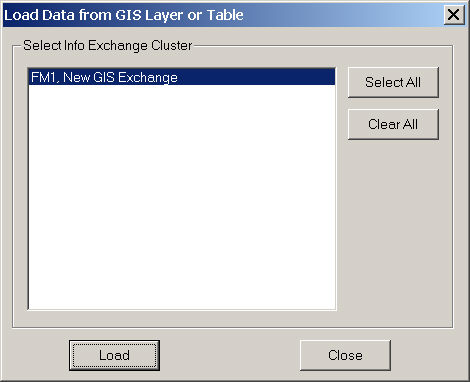
- Click on the Load button
 to launch the Load Data from GIS Layer or Table dialog box and select the desired GIS Exchange Cluster(s). Click on the Load button (from the Load Data to GIS Layer or Table dialog box) at the bottom to read data from the specified Geodatabases.
Save Data to Geodatabases
You can use InfoSewer to make any desired changes to your Geodatabases. Once the GIS Exchange Clusters have been defined and linked with the desired Geodatabase, click on the Save button ![]() from GIS Gateway dialog box to update the desired Geodatabases.
from GIS Gateway dialog box to update the desired Geodatabases.

For saving Geodatabases perform the following:
- Launch the GIS Gateway dialog box from the InfoSewer Control Center -> InfoSewer button -> Exchange pull down menu.
- Click on the Save button
 to launch the Save Data to GIS Layer or Table dialog box and select the desired GIS Exchange Cluster(s). Click on the Save button (from the Save Data to GIS Layer or Table dialog box) at the bottom to update the specified Geodatabases.

Leave a Reply