Introduction to InfoSewer SA
Welcome to the InfoSewer SA Help File! One of the most powerful GIS non Arc GIS based Sewer modeling software in the world with many tools for Sewer Design, Water Quality, Runoff, RDII and Steady State/EPS Modeling! We’d like to take this opportunity to thank our customers for using InfoSewer SA , and show and describe how this software can better meet your modeling needs. You can learn more About InfoSewer SA by clicking on the Pop Up Links in this Help Topic Table.
InfoSewer SA bridges the gap between network modeling and Arc GIS based software to support many types of applications in sewer collection system analyses, including the following features:
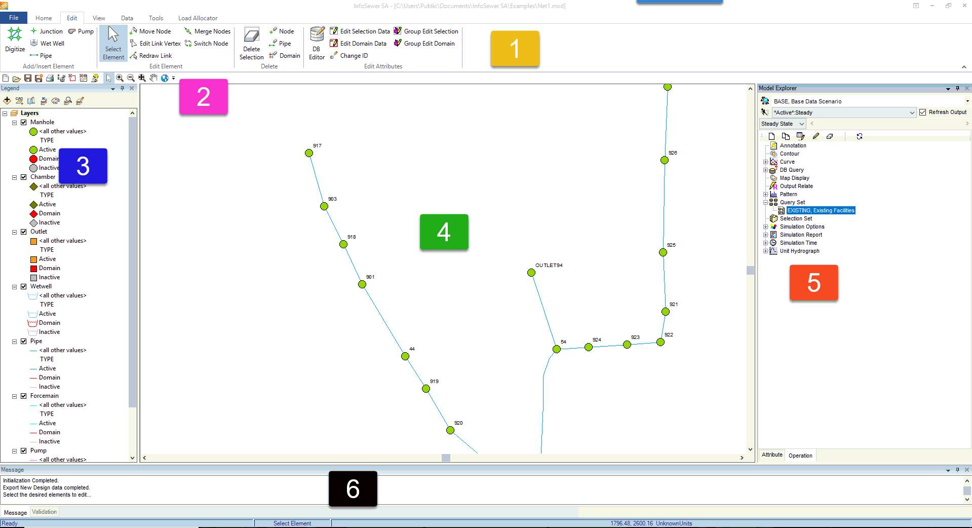
Here is an example of how the InfoSewer SA Interface looks (the Net1.MXD Example)
1. Ribbon
2. Quick Access Toolbar
3. Table of Contents
4. Map
5. Model Explorer
6. Message Board
![]()