Rational Method in InfoSewer and H2OMap Sewer Pro
InfoSewer H20Map Sewer Pro adds comprehensive rainfall-runoff and infiltration/inflow modeling capability on top of the sanitary sewer simulation features provided by InfoSewerH20Map Sewer , equipping the industry with a single powerful tool that can be used for planning, design, and operational management of sanitary sewer, storm sewer, and combined sewer systems. InfoSewerH20Map Sewer Pro shares all the features described above in relation to InfoSewerH20Map Sewer including the methodologies used to model the physical and the non-physical components of a collection system, steady state and dynamic analysis of sanitary loads, steady state design, dynamic routing of flows through the collection system, calculation of HGLs, and water quality modeling. This section presents the theory pertinent to InfoSewerH20Map Sewer Pro, which is stormwater modeling.
Determination of stormwater runoff resulting from rainfall event(s) is the most important component of stormwater management, and is commonly known as rainfall-runoff modeling. Similar modeling techniques are applicable to the determination of rainfall-dependent infiltration/inflow in separate sanitary sewer systems. There are various rainfall-runoff modeling techniques. The choice of the method to use depends, among other considerations, on the type of analysis (e.g., steady state or dynamic simulation) and the information required (e.g., peak flow or complete hydrograph). Peak flow information is appropriate for steady state simulation of sewer systems whereas knowledge of the complete hydrograph is essential for dynamic simulations.
For estimation of peak flow during steady state simulations, InfoSewerH20Map Sewer applies the Rational method, which is a very popular tool of choice used by many practicing engineers across the globe. For dynamic simulation, complete hydrographs are derived based on the practical and highly effective unit hydrograph theory. The unit hydrograph can be observed or synthetic. This method allows the entire hydrograph (including peak and volume) resulting from an actual or design storm event to be adequately simulated. The following sections describe the Rational method and the unit hydrograph techniques incorporated into InfoSewerH20Map Sewer .
Rational Method
The Rational method is the most widely used technique for estimation of peak flows from urban and rural drainage basins (Maidment 1993; Mays 2001). The concept of the Rational method is attractive and easy to understand. If rainfall occurs over a watershed at a constant intensity for a period of time that is sufficiently long to produce steady state runoff at a desired design point, then the peak flow rate will be proportional to the product of rainfall intensity and watershed area.
Mathematically, the Rational formula is expressed as:

The units need to be consistent. For example, if intensity is in ft/s and area is in ft2, then the resulting peak flow rate would be in cfs. InfoSewerH20Map Sewer allows several intensity unit alternatives (in/hr, mm/hr, in/min, mm/min). The area should be in acres if US Customary units are used, and in square meters for SI units. InfoSewerH20Map Sewerconverts the units internally to preserve consistency.
TIME OF CONCENTRATION
The Rational method is based on the premise that peak runoff occurs at a given design point when the rainfall duration is sufficiently long so that all locations in the watershed draining to the point contribute flow, and that intensity of the rainfall is constant for that duration. Some locations of the contributing subbasins are hydraulically closer to the design point and may yield runoff to the point sooner than other locations. The Rational method uses the concept of time of concentration to ensure contribution of all locations in the upstream subwatersheds to the design point. Time of concentration, from the perspective of the Rational method and storm runoff (not to be confused with the water quality definition given in preceding sections), is defined as the time it takes for a drop of water falling on the most remote point of upstream subwatersheds to reach the design point. Remoteness refers to hydraulic travel time rather than distance.
There are a number of empirical methods for estimation of time of concentration. The techniques are formulated as a function of subwatershed characteristics such as travel distance and subwatershed slope. InfoSewerH20Map Sewer calculates time of concentration as the sum of overland flow travel time and channel (pipe) flow travel time.
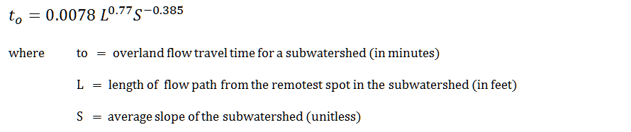
Pipe flow travel time is calculated using the flow velocity of the pipe and the pipe length. Overland flow travel time is calculated using the method derived by Kirpich, a technique commonly used in the US. Kirpich’s formula (Mays 2001) is given as:
There could be multiple flow paths from upstream subwatershed to a given manhole leading to different flow times. The time of concentration used by InfoSewerH20Map Sewer is the longest flow time among different possible flow paths to the manhole. In order to avoid unreasonably low storm duration and unreasonably high rainfall intensities, InfoSewerH20Map Sewer allows the user to specify a minimum time of concentration, and uses the maximum of the user-specified minimum time of concentration and an internally calculated time of concentration. The default minimum time of concentration used by InfoSewerH20Map Sewers 10 minutes.
RAINFALL INTENSITY
Rainfall intensity is defined as the depth of rain that falls in a given duration of time divided by that duration. It may rain harder (high rainfall intensity) for a short period of time, but the longer a rainfall event lasts, the lower its average rainfall intensity, implying that rainfall intensity is inversely proportional to the duration of a rainfall event.
Intensity of a storm is also a function of return period or frequency of the rainfall occurrence. Intense rainfall events occur less frequently than less intense storms. Return period, also known as recurrence interval, is defined as the expected length of time (e.g., T years) between occurrences of two storm events that exceed a given intensity. Return period does not imply that multiple rainfall events exceeding a given intensity will not occur within T years, nor does it assure occurrence of a storm event exceeding the intensity within T years. All it means is that the rainfall event will occur at an average rate of once in T years.
The higher the return period (i.e., the less frequent the storm event), the higher the intensity of the rainfall event would be. As an example, a storm with 10-year return period represents a rainfall event whose magnitude is expected to be exceeded once in ten years. This implies that the frequency of the storm event is 1/10, or that there is a 10% probability for the intensity of the storm event to be exceeded in any given year.
INTENSITY-DURATION-FREQUENCY CURVE
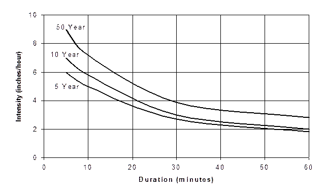
The relationship between rainfall intensity, rainfall duration, and frequency of occurrence of storm events is often presented for a certain region in the form of an Intensity-Duration-Frequency Curve, commonly referred to as an IDF curve. A sample IDF curve is given below for return periods of 5, 10, and 50 years. InfoSewerH20Map Sewer calculates the rainfall intensity used by the Rational method based on a user-specified IDF curve. The user should provide an IDF curve for a desired return period. The model derives rainfall intensity from the IDF curve corresponding to the duration equal to the time of concentration calculated for the manhole following the techniques described above.
RUNOFF COEFFICIENT
Runoff coefficient is loosely defined as the ratio of runoff to rainfall, and is a function of watershed characteristics including land use, soil type, and slope of the watershed. The value of runoff coefficient ranges between 0.0 and 1.0. A value of 0.0 means that all of the rainfall is lost in the form of abstractions such as infiltration, interception, and evaporation and none of the rainfall is converted to runoff. The value of 1.0 implies that all the rainfall is converted to runoff and is discharged from the watershed. As an example, most of the rain that falls on impervious areas such as pavement and roof would be immediately converted to runoff. A value of C for such land uses is close to 1.0. Runoff coefficient values recommended by the American Society of Civil Engineers and Water Environment Federation for return periods not exceeding 10 years are given below for various land uses, soil types, and slope conditions.
| Description Of Area | Runoff Coefficient |
| Business | |
| Downtown | 0.70 - 0.95 |
| Neighborhood | 0.50 - 0.70 |
| Residential | |
| Single-family | 0.30 - 0.50 |
| Multiunits, detached | 0.40 - 0.60 |
| Multiunits, attached | 0.60 - 0.75 |
| Residential (suburban) | 0.25 - 0.40 |
| Apartment | 0.50 - 0.70 |
| Industrial | |
| Light | 0.50 - 0.80 |
| Heavy | 0.60 - 0.90 |
| Parks, Cemeteries | 0.10 - 0.25 |
| Playgrounds | 0.20 - 0.35 |
| Railroad yard | 0.20 - 0.35 |
| Unimproved | 0.10 - 0.30 |
| Character Of Surface | Runoff Coefficient |
| Pavement | |
| Asphaltic and concrete | 0.70 - 0.95 |
| Brick | 0.70 - 0.85 |
| Roofs | 0.75 - 0.95 |
| Lawns, sandy soil | |
| Flat, 2% | 0.05 - 0.10 |
| Average, 2-7 % | 0.10 - 0.15 |
| Steep, 7% | 0.15 - 0.20 |
| Lawns, heavy soil | |
| Flat, 2% | 0.13 - 0.17 |
| Average, 2-7 % | 0.18 - 0.22 |
| Steep, 7% | 0.25 - 0.35 |
For return periods that exceed 10 years, the runoff coefficient from the table should be multiplied by a frequency adjustment factor, Cf , given below.
| Frequency (Years) | Cf |
| 25 | 1.1 |
| 50 | 1.2 |
| 100 | 1.25 |
For a subwatershed composed of multiple land uses, a composite runoff coefficient Cw should be determined by weighting C values of each of the land uses by their corresponding area according to the equation:.
![]()
where Ci = runoff coefficient for individual land use in the subwatershed.
Ai = area of the individual land use in the subwatershed.
N = total number of land uses in the subwatershed.
ASSUMPTIONS OF THE RATIONAL METHOD
For credible engineering application, the modeler needs to understand the following basic assumptions of the rational method. Firstly, the rainfall intensity is constant throughout the watershed over a period of time that equals the time of concentration of the analysis site. Secondly, the runoff coefficient is invariant, regardless of season of the year or intensity of rainfall. Finally, the area of the contributing watershed is small (not more than 300 acres).
THE SAN Diego Rational/Modifed Rational Method from Innovyze H2OCalc for Reference
The San Diego County hydrology manual (San Diego County, 2003) recommends rational method to compute peak storm flow for drainage areas less than 1 square mile. If more than one drainage path is flowing to a junction, the County recommends the modified rational method described below.
The county uses the following relationship to estimate design rainfall intensity (in/hr).
I = 7.44P6D-0.645
Where: P6 = 6-hour storm rainfall amount (in).
D = duration (time of concentration) in minutes.
The time of concentration is composed of the initial time of concentration and the travel time.
InfoSewerH20Map Sewer requires the user to provide initial time of concentration for each subwatershed.
The travel time is computed based on flow velocity and pipe length.
The modified rational method differs from the rational method only when a junction receives flow from two or more tributaries. The peak flow (Q), the time of concentration (Tc) and the rainfall intensity (I) for each of the independent tributaries is calculated according to rational method. The modified rational method is then used to determine Q, Tc and I for the confluence.
The rational method is used for the next point of interest along the flow direction.
Q and Tc, for each independent tributaries are ranked in order of increasing Tc. Let Q1, T1, and I1 correspond to the tributary area with the shortest Tc. Likewise, Q2, T2, and I2 correspond to the tributary area with the next longer Tc; and so on. The tributaries are combined as follows.
For T1 < T2 < T3,
QT1 = Q1 +
![]()
![]() ………………………….. (38)
………………………….. (38)
![]()
The largest of QT1, QT2 and so on and the associated Tc should be used for the junction. The equation can be expanded for more than three tributaries. InfoSewerH20Map Sewer can handle unlimited number of tributaries.