InfoSWMM SA View Menu
Map Menu - Use this to import or Export model data from or into an InfoSWMM SA project.
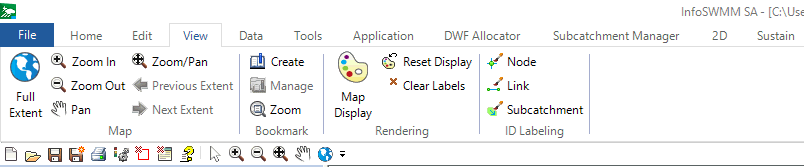
Map Menu
 Full spatial extent of the InfoSWMM SA Network.
![]() Zoom into the network elements.
Zoom into the network elements.
Zoom out in the network elements.
![]() Pan around the network elements.
Pan around the network elements.
![]() Zoom in or out and pan around the network elements.
Zoom in or out and pan around the network elements.
![]() The previous zoomed or panned extent of the network elements.
The previous zoomed or panned extent of the network elements.
![]() The next zoomed or panned extent of the network elements.
The next zoomed or panned extent of the network elements.
Bookmark Menu
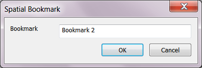
 Create a Spatial Bookmark
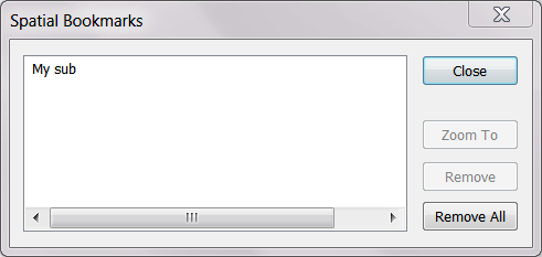
 Manage the Spatial Bookmarks
 Zoom to the Spatial Bookmarks
Rendering Menu
 The InfoSWMM SA Map Display feature may be used to annotate your map.
 Clears all color coding and selection windows in the map display. Resets the map display to the default colors
ID Labeling
 Turn on and turn off Node ID Labeling on the Map.
 Turn on and turn off Link ID Labeling on the Map.
 Turn on and turn off Subcatchment ID Labeling on the Map.